A Blatant Lie by BJ about Trade between NI and GB.

Status
Not open for further replies.

British army?

And where were those 'few checkpoints' located?

On the main roads. There's a little under 300 roads joining the north to the south, mostly small backroads, too many to 'man' so the majority of the roads might have a couple of concrete blocks dropped on them. I'm not sure what they did where farmhouses were intersected by the border making the lounge in the south and the kitchen in the north.

Even with manned checkpoints, it was still pretty porous, dat's how dey got the guns and explosives up to the north to be sure.
 
Sponsored Links
British army?


On the main roads. There's a little under 300 roads joining the north to the south, mostly small backroads, too many to 'man' so the majority of the roads might have a couple of concrete blocks dropped on them. I'm not sure what they did where farmhouses were intersected by the border making the lounge in the south and the kitchen in the north.

Even with manned checkpoints, it was still pretty porous, dat's how dey got the guns and explosives up to the north to be sure.
Precisely, UK introduced the border on the island of Ireland.
 
It is. It may come down to whether the GFA/BA has precedence, or the NI Protocol has precedence. But as the GFA/BA is now codified within the NI Protocol, I suspect that the GFA/BA may take precedence:
The Good Friday Agreement states that consent for a united Ireland must be “freely and concurrently given” in both the North and the South of the island of Ireland. This is widely interpreted to mean that future border polls must be held in Northern Ireland and the Republic of Ireland at the same time.
From your link.​

And if the north say's 'no'. It matters not what the south says, from the same link.
 
Sponsored Links
And if the north say's 'no'. It matters not what the south says, from the same link.
The reverse also applies.
I addition support for reunification in Ireland is growing:
The Irish nationalist party, Sinn Féin, has been polling higher than expected and according to one of the most recent opinion polls, has the highest support it has ever seen in the Republic. However, Sinn Féin has only fielded 42 candidates, about half the number fielded by the two main parties,
For many in Northern Ireland, the U.K.’s 2016 vote to leave the E.U. raised the question of whether or not to stay in the E.U. or the U.K. Many in Northern Ireland consider themselves more closely aligned to the E.U. and even “embracing or recognizing that element of Irish identity,” MacCarthaigh says.

Northern Ireland voted to remain in the E.U. by a majority of 56% to 44%. Since then, there has been a large increase in the number of people from Britain and Northern Ireland applying for an Irish passport. “I’m not saying they are turning from British into Irish but they are sort of manifesting their right to Irish citizenship by getting an Irish passport,” adds MacCarthaigh.

Feelings in Northern Ireland are complicated because membership of the E.U. has played an invaluable role in providing financial assistance to the peace process, helping to deliver much needed infrastructure projects and European trade provided an economic boost to the region. The E.U. also helped fund bodies aimed at fostering cross-community relations, helping to ease tensions.

While Sinn Féin has long held a goal of Irish reunification, the party’s surge in the polls is unprecedented.
https://time.com/5779707/irish-reunification-likelihood/
 
Last edited:
I doubt even your prowess on google will find a definitive number of checkpoints, keep trying though.
 
I doubt even your prowess on google will find a definitive number of checkpoints, keep trying though.
A few checkpoints, you said.

During the Troubles in Northern Ireland, there were British military checkpoints on main border crossings and UK security forces made the remaining crossings impassable.
The border is linked with 268 (often approximated as "up to 275") border crossing points.
https://en.wikipedia.org/wiki/Republic_of_Ireland–United_Kingdom_border
About 21,000 UK soldiers at the peak of the troubles.
 
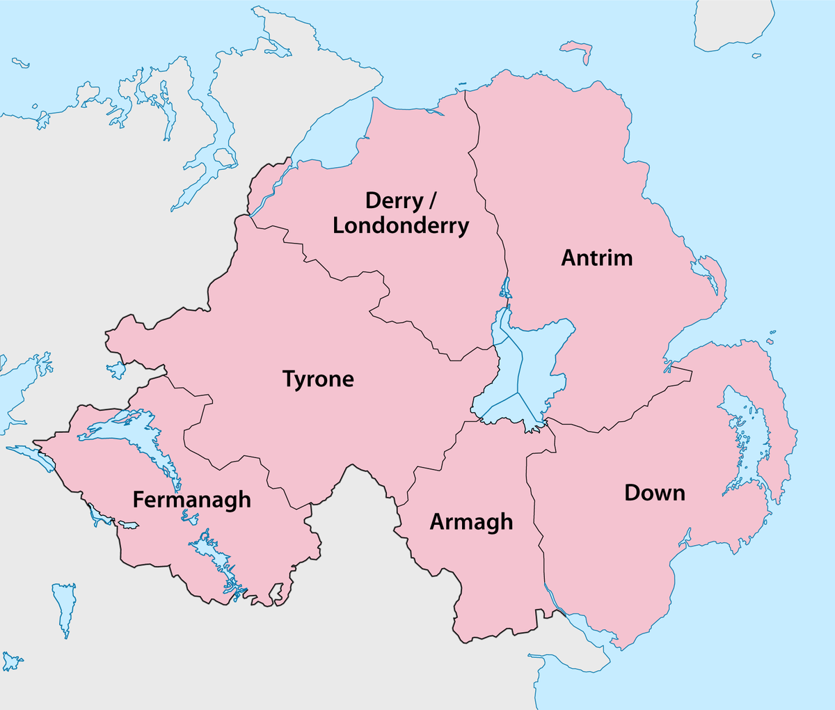
This is quite a good article, it suggests co Armagh and South Tyrone were the main areas to be fortified, which makes sense when you see a map. But believe me, there really was no Trumpian wall.

Road blocks, Check points and Watch towers, Queen Mary, University of London (irishborderlands.com)

The Irish border has had its greatest physical presence in the landscape in the form of the structures set in place to regulate and monitor movement across it. The practice of making roads impassable through various forms of roadblocks began in the first decades following Partition when attempts were made to prevent people avoiding custom points by using unapproved roads nearby. However, it was in the 1970s and 1980s that the blocked roads came to be such iconic images of the border and a dominant feature of borderlands life. From the 1970s roads were blocked by the security forces in attempts to prevent paramilitary movement across the border and to make the border impermeable except for the crossing points subject to security checks. Roads were blocked with reinforced concrete blocks, metal spikes and craters; bridges were destroyed to make border-crossings via minor roads impossible. In some areas these roadblocks were regularly challenged by locals who removed concrete blocks or filled in trenches and were regularly reinstated by security forces.

While over one hundred unapproved roads were blocked during the Troubles, the approved roads crossing the border featured the infrastructure of military checkpoints – soldiers, armoured vehicles and fortified buildings. Security measures also included covert military surveillance of border landscapes through the string of watchtowers that were erected on the hills of the border counties in Northern Ireland, especially in south Co. Armagh and south Co. Tyrone. These watchtowers dominated the skylines of the most heavily militarized districts of the borderlands. The army checkpoints that dominated the borderlands during the Troubles no longer exist. Following the paramilitary ceasefires of 1994 security measures were considerably reduced and formerly blocked border roads began to be re-opened. Watchtowers are now being dismantled in the post-conflict demilitarization of Northern Ireland. Travelling through the borderlands today, it is very difficult to find evidence of the roadblocks and checkpoints that once existed. They feature strongly in the stories of borderland lives but are largely now invisible in the landscape. Only the obviously new bridges that can be found along small country roads crossing the border suggest that they replace a bridge destroyed by the security forces.

1200px-Northern_Ireland_-_Counties.png
 
A few checkpoints, you said.

During the Troubles in Northern Ireland, there were British military checkpoints on main border crossings and UK security forces made the remaining crossings impassable.
The border is linked with 268 (often approximated as "up to 275") border crossing points.
https://en.wikipedia.org/wiki/Republic_of_Ireland–United_Kingdom_border


Like I said, just the main roads, how many main roads do you think there were? Most just had concrete blocks dropped on them which the farmers removed, then the army reinstated, then the farmers removed again.
 
Here's the main roads, I suspect the A3 and the A4 got a little lively at times.

20190101networkmap.gif
 
Like I said, just the main roads, how many main roads do you think there were?
During the Troubles in Northern Ireland, there were British military checkpoints on main border crossings and UK security forces made the remaining crossings impassable.
The border is linked with 268 (often approximated as "up to 275") border crossing points.
https://en.wikipedia.org/wiki/Republic_of_Ireland–United_Kingdom_border

:rolleyes:

But you dispute Wikipedia.
I suggest you correct their mistaken facts.
There's over 300 actual crossing points, including the minor roads.
 
But you dispute Wikipedia.
I suggest you correct their mistaken facts.
There's over 300 actual crossing points, including the minor roads.

That wiki link confirms everything I've said, you're wrong on the 300, there are 275 crossings.
 
Status
Not open for further replies.
Sponsored Links
Back
Top